


In late 2014, a significant geological report by JoAnne Nelson and Jeff Kyba of the British Columbia Geological Survey, Ministry of Energy and Mines was published entitled “Structural and stratigraphic control of porphyry and related mineralization in the Treaty Glacier – KSM – Brucejack – Stewart trend of western Stikinia”. This report, primarily focused on the Sulphuets Hydrothermal System including Treaty Creek, provided companies exploring in the Golden Triangle with a new geological understanding and what specific criteria to look for in the search for B.C.’s next big deposit. This new knowledge is being used effectively by companies across the Golden Triangle.
A Northern Miner article entitled “BC Survey's 'red line' a game changer for explorers” did a good job of summarizing the extensive report and essentially stated that Nelson and Kyba may have unlocked the secret to world-class porphyry and intrusion-related gold-copper deposits in northwestern B.C (click imbedded link above for full article).
The report revealed that most of the major deposits in the region occur within 2 km of a regional stratigraphic contact, and according to Kyba, there are lithological and structural clues to narrow that window even more. What they found was a unique package of basal conglomerates and turbidites along the Stuhini-Hazelton group stratigraphic contact.
Kyba mentions he has an “open-door” policy on the data he uses, and offers explorers a geological map that highlights the prospective contact as a thick, red line.
“If you’re near that red line, and there’s a clastic sequence coupled with large-scale faults, then you might be in the neighbourhood of B.C.’s next big deposit,” he says. “And knowing that is a big game changer for explorers in the region, because it’ll get them closer to making a discovery.”
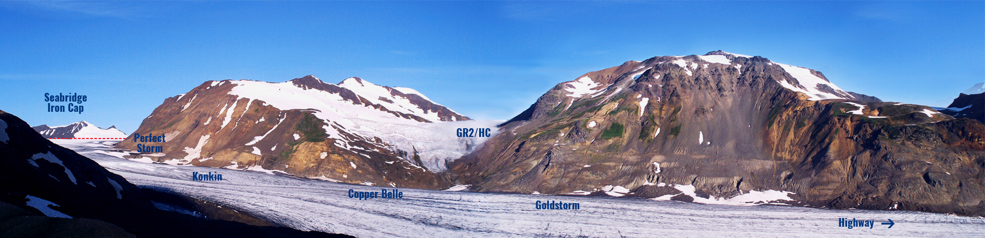
This red line or “Discovery Contact” runs right through the middle of the entire Sulphurets Hydrothermal system including Treaty Creek. More specifically, it runs along the West Nunutak located in the heart of the Treaty Creek property. This gossanous ridge hosts multiple zones of mineralization including the SW, AW, NW, Konkin, Goat Trail, GR2/HC, Copper Belle, and Goldstorm zones. These mostly high-grade zones are surface expressions (deposits?) of a large scale mineralized system taking place at depth for kilometers down the length of the West Nunutak.
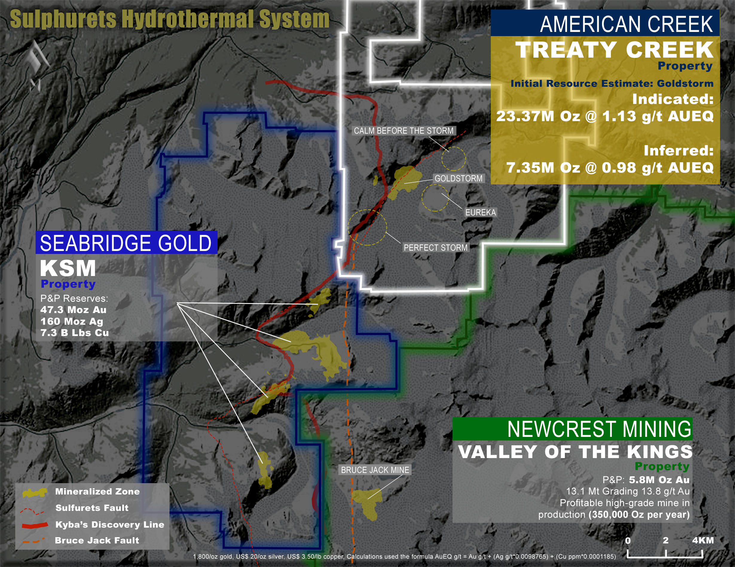

Kyba points out that there are more factors at play than just the Discovery Contact. He also points out there needs to be a clastic sequence coupled with large-scale faults. Clastic sequencing (basal conglomerates and turbidites) on Treaty Creek are noted extensively in both the property summary reports and the Kyba report. The Sulphurets thrust fault that Seabridge Gold states is directly associated with their deposits also runs through the heart of Treaty Creek.
There are three major contributing factors in determining “if you might be in the right neighbourhood of BC’s next big deposit” and Treaty Creek has all three qualifiers coinciding with each other.